Author Archives: Laurence Aurbach

Fun with Density and Transit Statistics

Conventional wisdom holds that the U.S. is too spread out for workable mass transportation except in a few high-density cities. Urban planning expert Anthony Downs offers this explanation:

But in 2000, at least two thirds of all residents of U.S. urbanized areas lived in settlements with densities of under 4,000 persons per square mile. Those densities are too low for public transit to be effective. Hence their residents are compelled to rely on private vehicles for almost all of their travel, including trips during peak hours.

Traffic: Why It’s Getting Worse, What Government Can Do

Is that accurate? It all depends on statistics and assumptions, both of which are endlessly susceptible to manipulation. For instance, Downs uses “settlements” as the geographic unit of analysis and calculates how many Americans live below a certain density threshold.

That’s one approach, but there are many different approaches. We could use other geographic units and find out the average density in each of them.

Geographic Unit Population Population
% of U.S.
Land Area
(sq mi)
Land Area
% of U.S.
United States 281,421,906 100 3,537,438 100
Metropolitan Areas 225,981,679 80.3 705,790 20
Urbanized Area 192,323,824 68.3 72,022 2

Source: U.S. Census 2000

Looking at the entire United States, what impresses is the vastness and diversity of the land. It’s the America of spacious skies, amber waves of grain, and purple mountain majesties; of trackless tundra, sizzling deserts and rocky badlands.

But look at the urbanized area of the nation and a different picture emerges. Sixty-eight percent of Americans live on just 2 percent of the U.S. land area. Seen in this light, the large majority of the U.S. population is remarkably concentrated on the land. What implication does this have for population density?

Read more

Connectivity Part 6: Vehicle Miles and Traffic

This is part 6 of a series. See also IntroductionHistorical BackgroundLatter Half of the 20th CenturyNeighborhood WalkingNeighborhood CrimeCrash Safety

Automobiles have brought many benefits to society, and at the same time there are many good reasons to reduce the number of vehicle miles traveled (VMT) each year. Thoroughfare connectivity is part of the strategy that reduces VMT; it is a necessary, but by itself insufficient, component of walkable environments. Also, well-connected thoroughfares can reduce traffic congestion by providing alternate travel routes, and can speed emergency services by providing more direct routes and better accessibility.

There’s a nascent movement to advance better-connected thoroughfares, but meanwhile the inertia of preexisting standards and regulations discourages or prohibits high connectivity for most new construction. In addition, NIMBY residents are frequently opposed to new street connections. Future trends in energy, environmental and cultural conditions, however, could lead to walkable, well-connected thoroughfare layouts becoming more customary.

Read more

The Enclosed Mall Goes Extinct

In a Sarasota Herald Tribune article titled “Trend could spell trouble for malls,” the appropriately-named Devona Walker writes a lede that makes you go “Hmmm…”

The American mall, with its department store anchors, culinarily challenged food courts, concrete shells and native denizen, “the mall rat,” is becoming an endangered species.

One anchor mall is being built in 2007 and none are planned for 2008.

What is being built in massive quantities are “off-the-mall” retail and urban-friendly, largely upscale, open-air lifestyle and mixed-use retail centers.

Yes, the trend is old news by now. Still, I was unaware that it had reached the terminal point. Instead of endangered species, a better term (at least as regards new construction) may be extinct.

Read more

Suburban Poverty

An article by Eyal Press titled The New Suburban Poverty, in The Nation magazine, reports a stunning fact about the American suburbs:

Stories of downward mobility in America’s suburbs have not exactly cluttered the headlines over the past decade. Gated communities of dream homes, mansions ringed by man-made lakes and glass-cube office parks: These are the images typically evoked by the posh, supersized subdivisions built during the 1990s technology boom. Low-wage jobs, houses under foreclosure, families unable to afford food and medical care are not. But venture beyond the city limits of any major metropolitan area today, and you will encounter these things, in forms less concentrated — and therefore less visible — than in the more blighted pockets of our cities perhaps, but with growing frequency all the same. …

The result is a historic milestone that has gone strangely ignored: For the first time ever, more poor Americans live in the suburbs than in all our cities combined.

Read more

Granite Curbs

Washington Post columnist John Kelly looks at street curbs in Answer Man Favors Accessorizing the Streets. Kelly receives a question from some DC visitors who notice that the curbs are made of attractive granite instead of prosaic concrete. They ask,

As we had recently upgraded our own kitchen surfaces with granite, at a cost of several thousand dollars, we wondered how the use of such an expensive material can be justified by the city.

Turns out the granite saves labor and money in the long run. Ordinary concrete lasts 10-20 years depending on usage and conditions, while granite lasts many decades or even centuries.

Yes, it’s more expensive than concrete — about $45 per linear foot vs. $25 — but it’s more durable, said Abdullahi Mohamed, a supervisory civil engineer with the D.C. Department of Transportation.

Granite — solid, heavy — resists road salt and errant snowplow blades. When there’s roadwork to be done, granite curbs can be lifted up, set aside, then put back in place.

Apart from the bookkeeping issues are those of community pride and urban beauty.

Answer Man thinks that wherever possible we should strive for beauty, even in the lowly and the mundane. After all, Washington is a city of straight lines, from the grid that Pierre L’Enfant drew when he laid out the city to the knife’s edge walls of the National Gallery of Art East Building. Granite curbs help to crisply delineate the landscape, separating street from sidewalk and reminding us that it’s nice to live in a beautiful city.

A video supplementing Kelly’s column is available. Also, the American Granite Curb Producers website provides detailed information about performance and costs.

The Anatomy of DC Storefronts

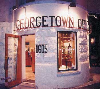
Planners and urban designers often talk about the “human scale” in walkable areas. But what does that really mean — is it simply a case of “I know it when I see it”? Are there more specific ways for people to describe why some building frontages seem especially friendly and welcoming?

shopfront_optician.jpg

For the design of storefronts, a very useful booklet is Thrive: A Guide to Storefront Design in the District of Columbia (2002), by Derrick Lanardo Woody. The booklet covers the elements of human-scale storefronts in an easy-to-understand format and with plenty of photos.

Read more

Accelerated Depreciation = Accelerated Suburbia

The following is an excerpt from the article “Talking Shopping Center” by Tom Hanchett.

The thing that struck me as I started my research was how long it took for that idea to catch on. Despite wide publicity for that first one [Country Club Plaza in Kansas City], shopping centers remained a rarity for thirty years. The problem was cost. Erecting a big new shopping center made economic sense only in very well-to-do neighborhoods. If you’re a real estate developer, it makes much more sense just to sell house lots because you get your money back immediately. You have to operate a shopping center for many years before you make a profit. In Kansas City, the developer was already making a bundle of bucks from his lot sales and he figured he could sell even more houselots by building that shopping center — as an attraction, a loss leader.

Not until the mid 1950s did shopping centers appear in any numbers. The first enclosed shopping mall is generally considered to be Southdale Mall, built in 1956 outside of Minneapolis. Then suddenly shopping centers take off, and they’re EVERYWHERE. Why then? Why so suddenly?

Read more

Redwood City’s Free-Market Parking Meters

At first glance the notion of free-market parking meters seems impossibly arcane. But as Donald Shoup pointed out in a recent NY Times editorial, “cruising for curb parking generates about 30 percent of the traffic in central business districts.” Shoup studied Westwood Village, next to the UCLA campus, and found that drivers searching for curb parking created 950,000 excess vehicle miles of travel per year. That’s equivalent to 38 trips around the earth, taking place in just one retail district in L.A.

Shoup calls the impacts of parking space cruising “astonishing,” and he’s right. The unnecessary traffic congestion hurts downtown businesses and activities. The extra miles traveled waste gasoline and generate pollution. If curb parking could somehow be freed up so that it was always easy to find a space, then that extra waste and pollution could be eliminated.

One solution is free-market parking. Set parking meter prices so that 85% of spaces are occupied and 15% are open at any given moment. This idea has been getting more attention lately, and Redwood City, CA, is the locality that has put the most advanced implementation into action.

Read more

Pringle Creek’s Porous Pavement

On March 26, Pringle Creek in Salem, OR was named Land Development of the Year by the NAHB’s National Green Building Awards. The designation is a new category for the Green Building Awards, and Pringle Creek is the first development to win it.

Pringle Creek is pursuing a full suite of sustainability practices. One of the more experimental is the system of porous streets that capture and purify stormwater runoff. The developers call it an “innovative storm water management system utilizing the largest community porous asphalt and concrete road system in North America.”

Here’s a cross-section of the street design:

Read more

The Density of Traditional Urbanism

Terry Holzheimer, economic development director for Arlington, VA, had a clever idea. Usually the density of neighborhoods is measured in residents per acre. But historic neighborhoods and transit oriented development are mixed use, so there may be all sorts of activities that don’t get counted by the usual methods. Why not add residents and jobs together to get a measure of “overall intensity”?

That’s exactly what Holzheimer did in his short paper, Urban Development Intensities in the Washington, DC Metropolitan Area. He looked at overall intensity for historic neighborhoods and for new, transit oriented, mixed use centers. For good measure, he also looked at suburban employment centers, including the so-called edge cities like Tysons Corner.

The unexpected conclusion: Historic neighborhoods are more intense than edge cities.

Read more

Photo Gallery: Québec City

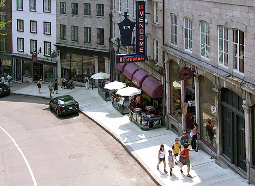
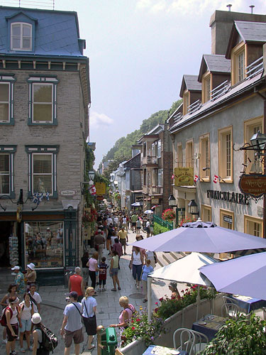
Québec City in the province of Québec: 399 years old and going strong. A few existing sections remain from the 17th century, and most of the Old Town was built during the 18th and early 19th centuries.

quebec_hill.jpg
Climbing the cliff from Lower Town to Upper Town on Côte de la Montagne.

quebec_lower_town.jpg
At the foot of the funicular (an easier way to travel up the cliff) on the Quartier Petit Champlain commercial street.

Read more

A Global Turning Point

As the U.N. observes, 2007 is a turning point in global history. For the first time in the history of humankind, the majority of people are city dwellers.

A New York Times profile of visionary Stewart Brand describes his view of a rapidly urbanizing world:

He now looks at the rapidly growing megacities of the third world not as a crisis but as good news: as villagers move to town, they find new opportunities and leave behind farms that can revert to forests and nature preserves. Instead of worrying about population growth, he’s afraid birth rates are declining too quickly, leaving future societies with a shortage of young people.

Indeed there is good news and new opportunities; and yes, some of the abandoned hinterlands are regenerating their natural vegetation. However, there is far too much misery and suffering in the global urbanization trend to unreservedly label it as beneficial.

Some of the numbers are fairly well known and covered in publications like the U.N.’s The Challenge of Slums (2003). There are a billion slum dwellers in the world, trying to cope with increasing rates of unemployment, malnutrition, disease and illiteracy. That’s one third of all city dwellers worldwide.

The problems of sanitation and shelter are familiar, but an entirely different type of scourge is making surprising advances in developing nations: traffic crashes. In fact, over the next thirteen years, traffic crashes will become the third-biggest death/disease factor worldwide.

Read more

Close Encounters With Buildings

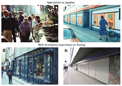
This was published a few years ago, but I just came across it recently. It is Close Encounters With Buildings, an article by Jan Gehl, Lotte Johansen Kaefer, and Solvejg Reigstad. Gehl is one of the world’s leading urban designers and author of several books including the pathbreaking Life Between Buildings.

“Close Encounters With Buildings” provides an explanation and definition of pedestrian-scale facade design. It reviews several systems for understanding and classifying the characteristics of facades which can either enhance or diminish the attraction and liveliness of pedestrian space.

gehlschema.jpg

Read more

Connectivity Part 5: Neighborhood Crime

This is part 5 of a series. See also IntroductionHistorical BackgroundLatter Half of the 20th CenturyNeighborhood WalkingVehicle Miles and TrafficCrash Safety

In America for a long while now, the conventional wisdom has been that isolation equals safety. In that viewpoint, one achieves maximum safety in a home that is hidden from public view, located on an isolated cul-de-sac, placed in a walled, gated community, and removed from the center city to the far exurban fringes of the metro area.

But does that model provide the best security in all situations? Or does designing for isolation sometimes provide an illusion of security?

Burglaries and street crime result from a nexus of factors, including demographics, individual psychology, and environment. Design plays a role as well. The conventional assumption is that greater isolation protects against crime, but researchers are finding that long, isolated cul de sacs with homes that are not visible from the street have higher crime rates. Crime researchers recommend breaks in the street network only under certain limited conditions.

Read more

Neighborly Housing

Two recent articles of note.

1. Buyers Value ‘Neighborly’ Housing, Study Finds
College of Urban Planning and Public Affairs, University of Illinois
February 5, 2007

Chicagoans who buy new housing in low-income neighborhoods prefer homes that are integrated into the neighborhood and not isolated from it, according to a new report by University of Illinois at Chicago researchers.

Buyers are willing to pay 33 percent to 50 percent more for units in single-family or small multi-family buildings with entrances that face the street and parking that faces the alley, according to the report published in the Winter 2007 issue of the Journal of the American Planning Association. Buyers also favor relatively short setbacks from the street and construction materials similar to those used in neighboring buildings.

The working paper is available from the Lincoln Institute of Land Policy: Does Urban Design Influence Property Values in High-Poverty Urban Neighborhoods?

2. Rethinking Suburbia
Style Weekly, Richmond VA
February 7 – 14, 2007

Neighborhoods that once held the suburban dreams of many have become havens for crime and the all-too-familiar problems of the inner city.

… It’s difficult for many to fathom that the old suburbs, even in their grimiest state, could somehow foster the kind of crime and dereliction that plagues the inner city, places like Gilpin and Mosby courts. But it’s already started.

Combined, Chesterfield and Henrico recorded 14 murders in 2006 and 23 murders in 2005, the biggest indicator that violent crime has moved in, albeit mild compared with the 83 murders in Richmond last year.

The signs of decline, however, are everywhere. In “Tomorrow’s Cities, Tomorrow’s Suburbs,” University of Virginia urban studies professors William Lucy and David Phillips argue that the older suburbs are actually far worse off than many inner cities for several reasons.

More information about “Tomorrow’s Cities, Tomorrow’s Suburbs,” including the table of contents and ordering info, is available from the American Planning Association.